River Axe
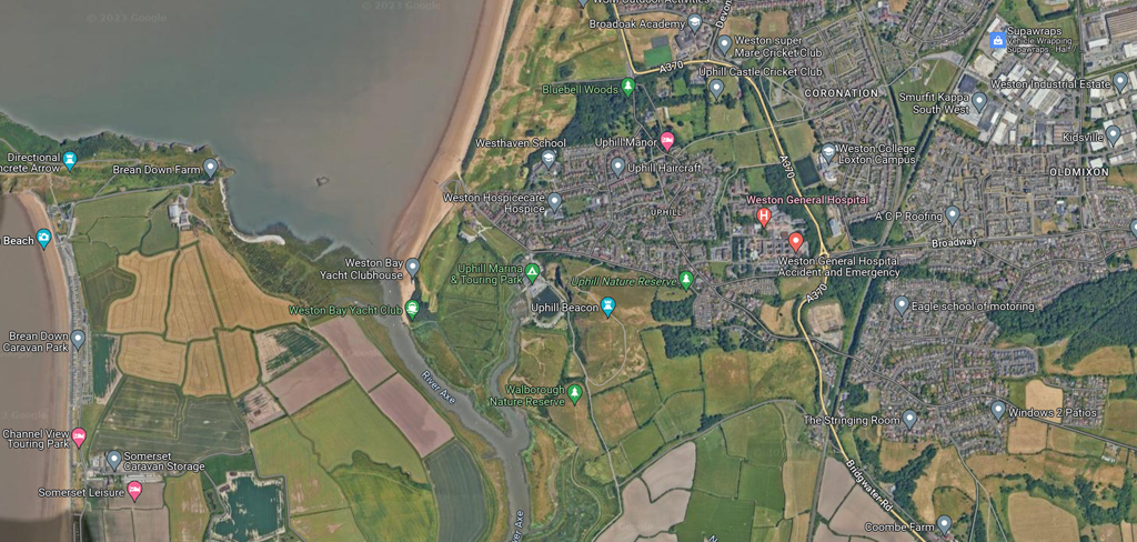
The River Axe and the Pill are Crown Estate property up to mean high water. Tidal land, other than the wharf, are privately owned and the whole area is an SSSI.
Mooring leases are held by Uphill Boat Services for The Pill, The Licensed Boat and Fishermen’s Association for the bank across from the club with about 20 moorings with WBYC Moorings Committee managing the remainder of the river. Should you want to keep a boat on the River Axe and would like a permanent mooring a licence is required and an annual rent paid.
The lower reaches of the Axe have a history of navigation from Uphill through to Lower Weare. The current navigation limit is the sluice gate at Bleadon and Brean Cross.
In the Middle Ages overseas trading was carried out from the port of Rackley, which is now North of the river; the course having been diverted. Rackley is currently a farm below Crooks Peak, West of Axbridge. There where wharves there. In the 14th Century it is known that a French ship sailed up the river, and by 1388, Thomas Tanner from Wells was using Rackley to export cloth and corn to Portugal, importing iron and salt in exchange. Later, slate was imported on this route.
It may still have been possible to trade through Rackley were it not for the installation of a flood gate at Bleadon and the drainage of the river through a 1915 Act of Parliament.
Bleadon had been a small port, also known as Lympsham Wharf, for many years . This was the furthest navigable point after the advent of the railway in 1841. During the early part of the 20th Century, Lympsham Wharf was mostly used as a transport hub for coal imported from Wales.
A series of 11 watermills were powered by the river, of which only one remains, at Burcott.
Boat Yard
Uphill Boat Services (Tel. 01934 418617) runs the yard which provides a wide range of services including a workshop, and storage.
There are pontoon berths at the Wharf and some moorings near the entrance of the pill.
Uphill Village
Uphill is a scenic, historic village on the South side of Weston Bay, which extends between Brean Down to the South, Birnbeck Island and the old pier to the North.
Uphill is only a stones throw along the beach from the bustling resort of Weston super Mare – but could not be more different in character – being totally ‘undeveloped’.
A corner shop, an ice cream van on the beach, a couple of pubs and a restaurant – that’s your lot!
Uphill Wharf
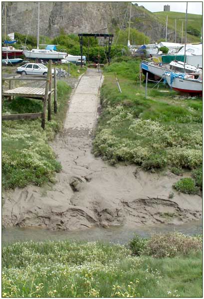
Uphill has a long history of being a port where coal from Wales was landed by sailing barges who then loaded with limestone from the quarry as the return cargo. All that is left is the quary face some 30 metres high and below it what is left of the wharf and a boat yard.

There is a stretch of water known locally as The Pill (actually the Uphill Great Rhyne – pronounced ‘Reen’) leading from the wharf to the River Axe which can only be navigated about one and a half hours either side of high water and should never be used at the top of a spring tide. Because …
The wharf is an area of land used as common land by boat owners at the top end of the pill. Boats are stored here on trailers, in slots cut in the river bank or on the grassy area which floods on the highest tides. Contact the club before using this area.

